Note: This is a continuation of my ongoing reporting of the Mountain Valley Pipeline and its destructive impacts upon the people and environment in West Virginia and Virginia.
BIG ISAAC, W.Va. – When the Mountain Valley Pipeline (MVP) had just started surveying in the mountains of North Central West Virginia in 2015, landowner and farmer Robert McClain wrote the MVP – twice – warning of catastrophic flooding and other dangers to his farm and surrounding community if the MVP stuck to its plans. (Excerpts from Mr. McClain’s letters are near the end of this article).
He never received an answer from the MVP to those letters, but McClain, 77, now looks to be a prophet. Or perhaps he is simply a West Virginian who knows that water flows downhill. Because even though the MVP never answered McClain’s letters, a flash flood that occurred on Sept. 9, 2023 has demonstrated that MVP can’t ignore gravity.
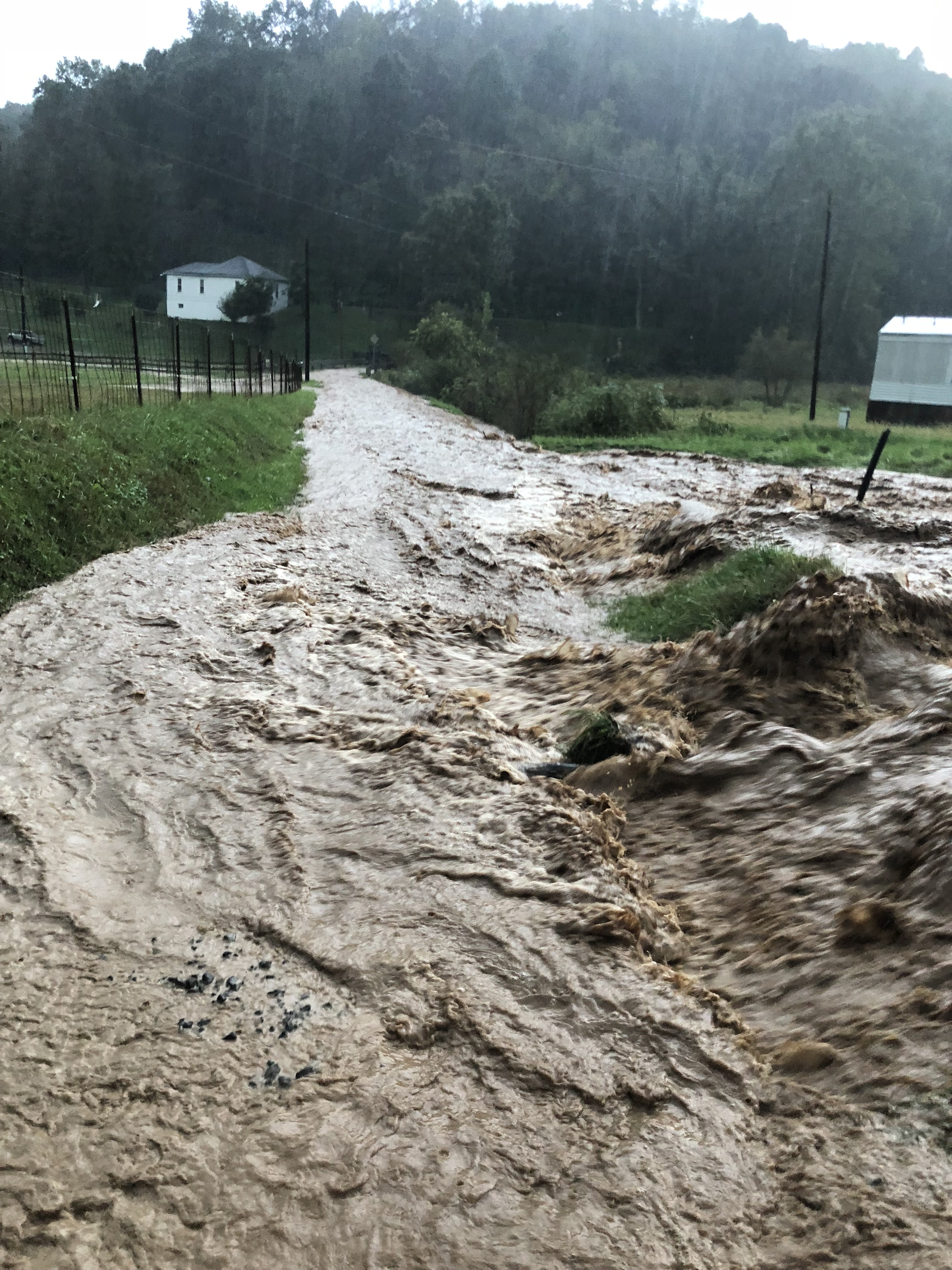
That was made evident on that Saturday evening, when Mr. McClain and his son, Justin, returned home about 8 o’clock in the evening from an outing that day to find their farm was flooded. Justin recalls, “It had rained that day before we got home. It had stormed about 6 o’clock.” He adds, “We couldn’t get up the road to the house. Water was running down it. Fish were flopping in the road from where the water had run down the hill over a neighbor’s pond.” Slowly, they made it out of the swift water up the road and into their driveway. The water had gotten nearly four feet high where they first come onto their land, Justin found the next day. The gravel from the county roadbed had been largely swept away. The neighbor’s pond is up the hill from the McClain family farm and directly below the MVP Right-of-Way (ROW) – the path the pipeline follows.
It isn’t the first time such an event has occurred said Justin. “It’s an ongoing thing. This has been going on since they started construction.” He added, “These are floods that supposed to happen once in a lifetime. Now they’re happening regularly.” Indeed, Robert’s wife Ann took photos in May of this year of a similar event. Another happened in early October, 2018 and at other times as well. A neighbor also took photos the evening of Sept. 9. They capture the gravity of these events.
So on Sunday, the cleanup began – by Justin, Robert, and a neighbor. Not present to help were MVP employees, or any local or state officials. Justin shares, “We were raised not to work on Sunday. But we had to. Forty feet of the county road was washed out. The neighbor used the tractor to shovel for three to four hours and then another two hours with his backhoe. I just had to pile it up. I don’t have a dump truck to haul it. It looked awful.”
Justin explains, “We had to clean the road so that kids could be driven to the road for the school buses. We worked five more hours on Monday.” In the process, his side-by-side was damaged. “We got into some sort of muck or sediment. It caused $300 of damage to the clutch and belt to pick up the debris.” He continues, “There were loose posts. Lots of them. We found a stick that said MVP on it.”
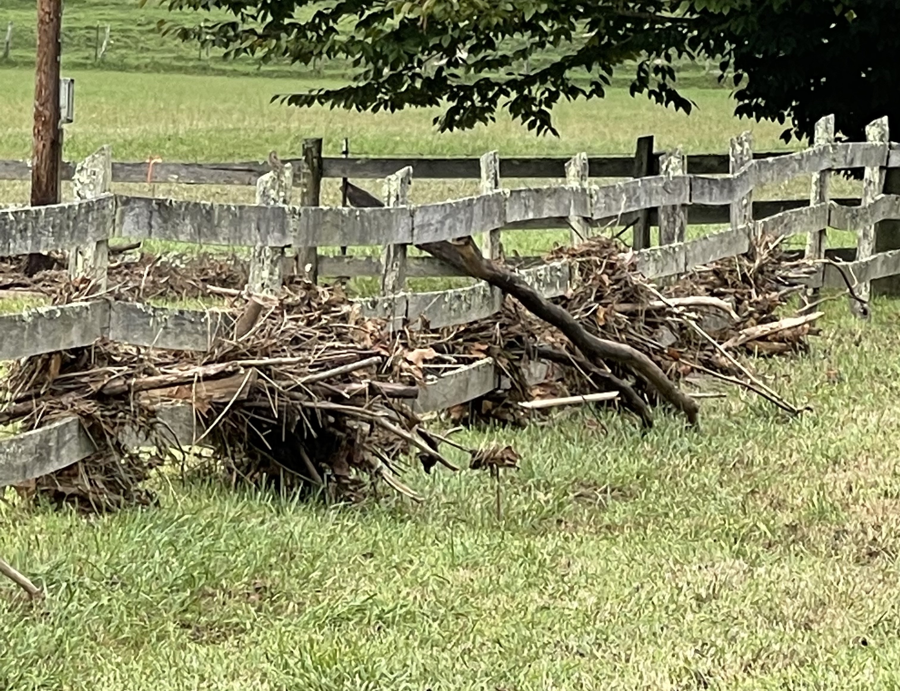
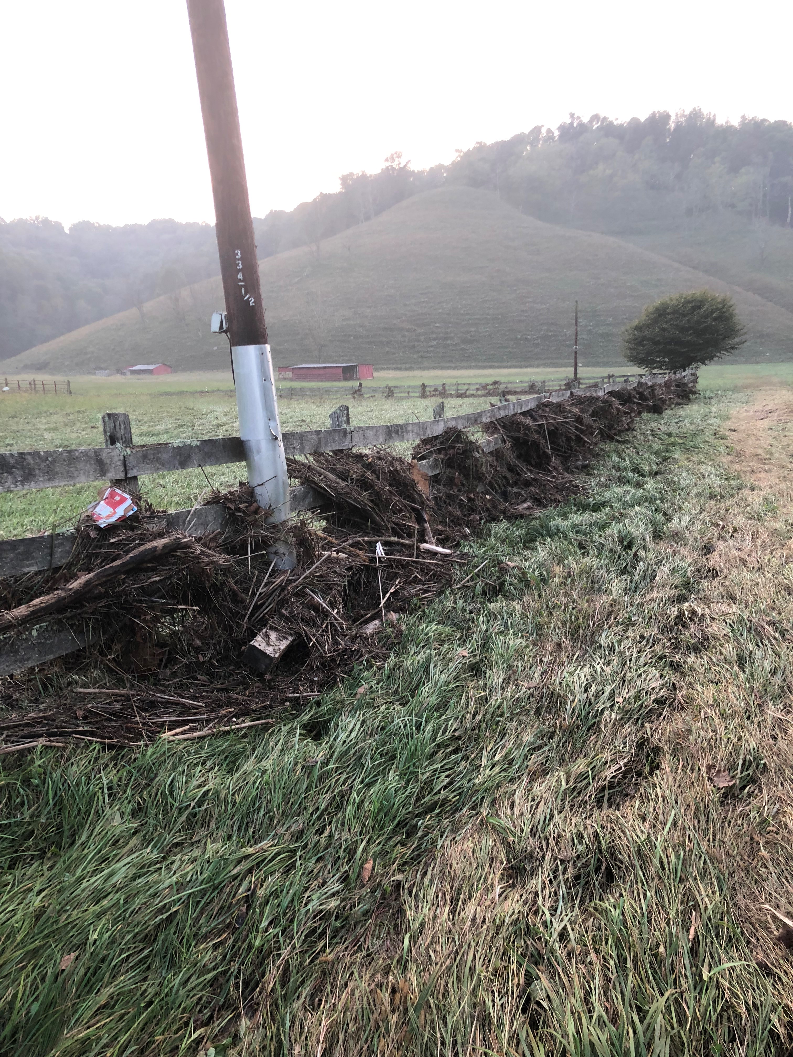
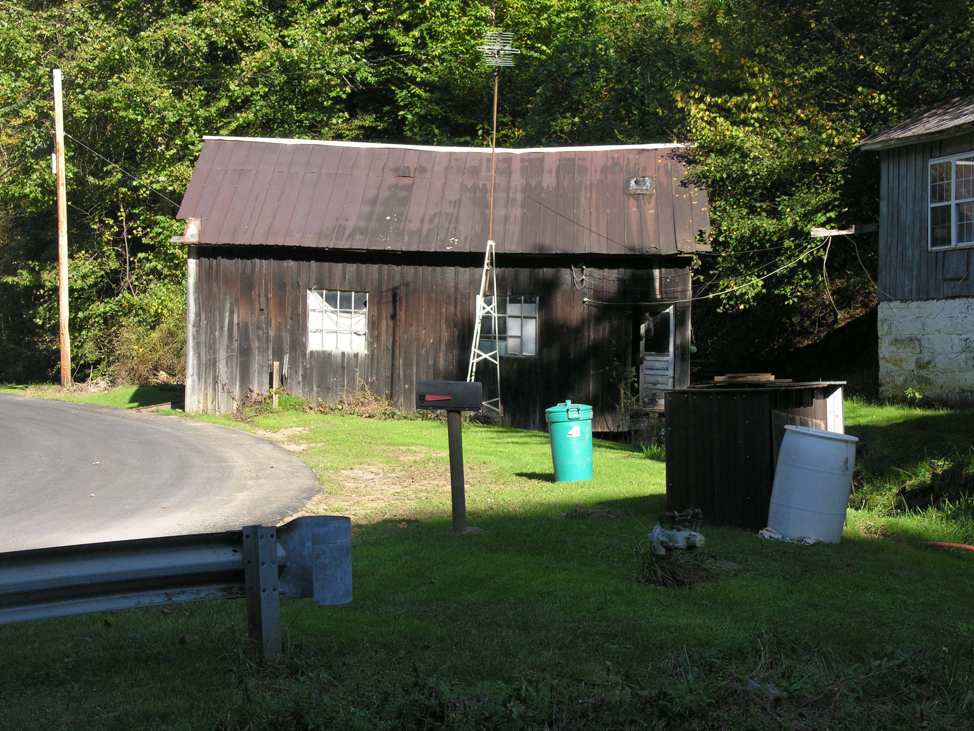
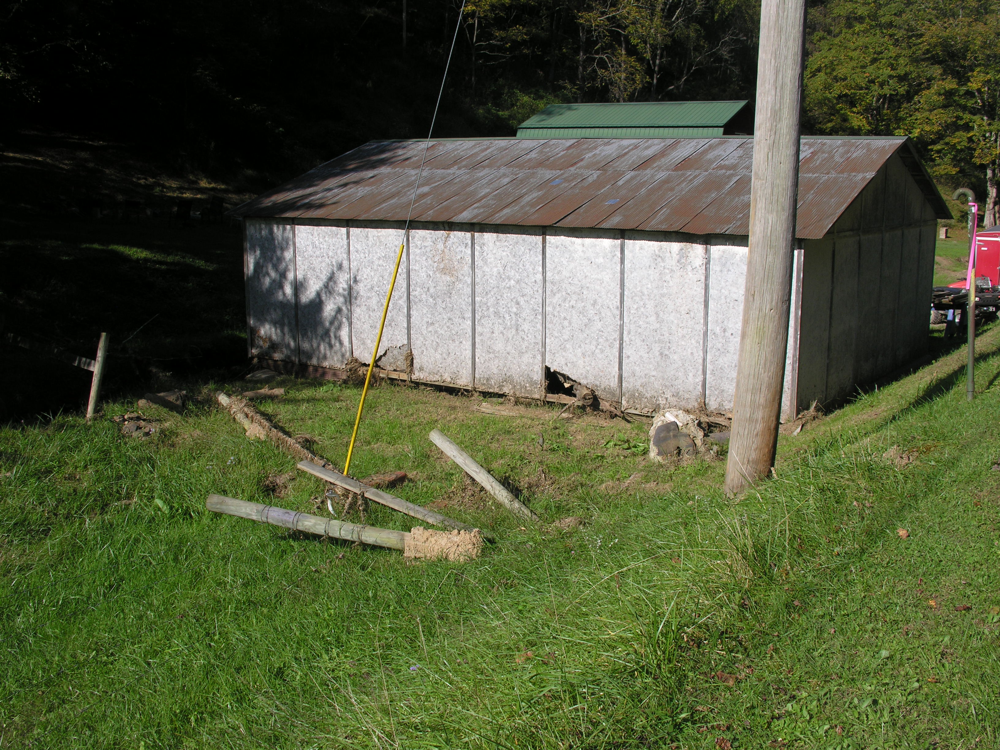
The water flooded their front pasture, leaving rocks, debris and sediment behind. Debris littered the road and was caught in their fence. The extent of the water overflowing their pasture on Sept. 9 is captured in the two photos of the same barn, seen below. A neighbor took a photo of the flooded pasture.

Authorities Having Jurisdiction Side with the MVP
The McClain family is not strangers to local, state and federal authorities as they’ve dealt with the MVP’s tactics for eight years. So, Justin and Robert McClain started calling every relevant authority that they could think of starting on Sunday. Beginning locally, they spoke with George Eidel, the Floodplain Manager and Director of the Office of Emergency Services for Doddridge County.
He visited the McClain family residence on the Monday following the Saturday rainstorm. While Justin claimed that Eidel said the MVP ROW was responsible, in an interview with me a few days later, Eidel said, two inches of rain fell and he blamed the flooding on a culvert adjacent to the county road. “This was a very, very isolated rain storm, he said.” Because the culvert is on private property (of a McClain neighbor), the MVP and the West Virginia Department of Transportation (DOT) are not responsible for cleaning or replacing the culvert said Eidel; it is the responsibility of the landowner. The culvert in question is about 20 inches in diameter. The volume of water seen in the photos by Ann McClain is far beyond what that culvert – full or empty – could be expected to handle.

WV DEP Inspector Timothy Wine inspected the MVP ROW on September 13 and found “no deficiencies” in the MVP Stormwater Pollution Prevention Plan (SWPPP). He also wrote in his report, “I was met on the site by Rodney Minney, Environmental Inspector for MVP, and had informed him that there were no deficiencies noted on the site. He had informed me that the area had received between 3” and 3.5” of rain in a short period of time over the weekend and the streamway of Meathouse Fork had discharged out of its bank and flooded out into fields, including flooding onto a portion of the company’s LOD located near Meathouse Fork Rd that 3.5 inches fell based on a rain gauge reading.”
Natalie Cox, spokesperson for the MVP did not return questions sent by email. J. D. Hoyle with FERC said, “I can’t respond.”
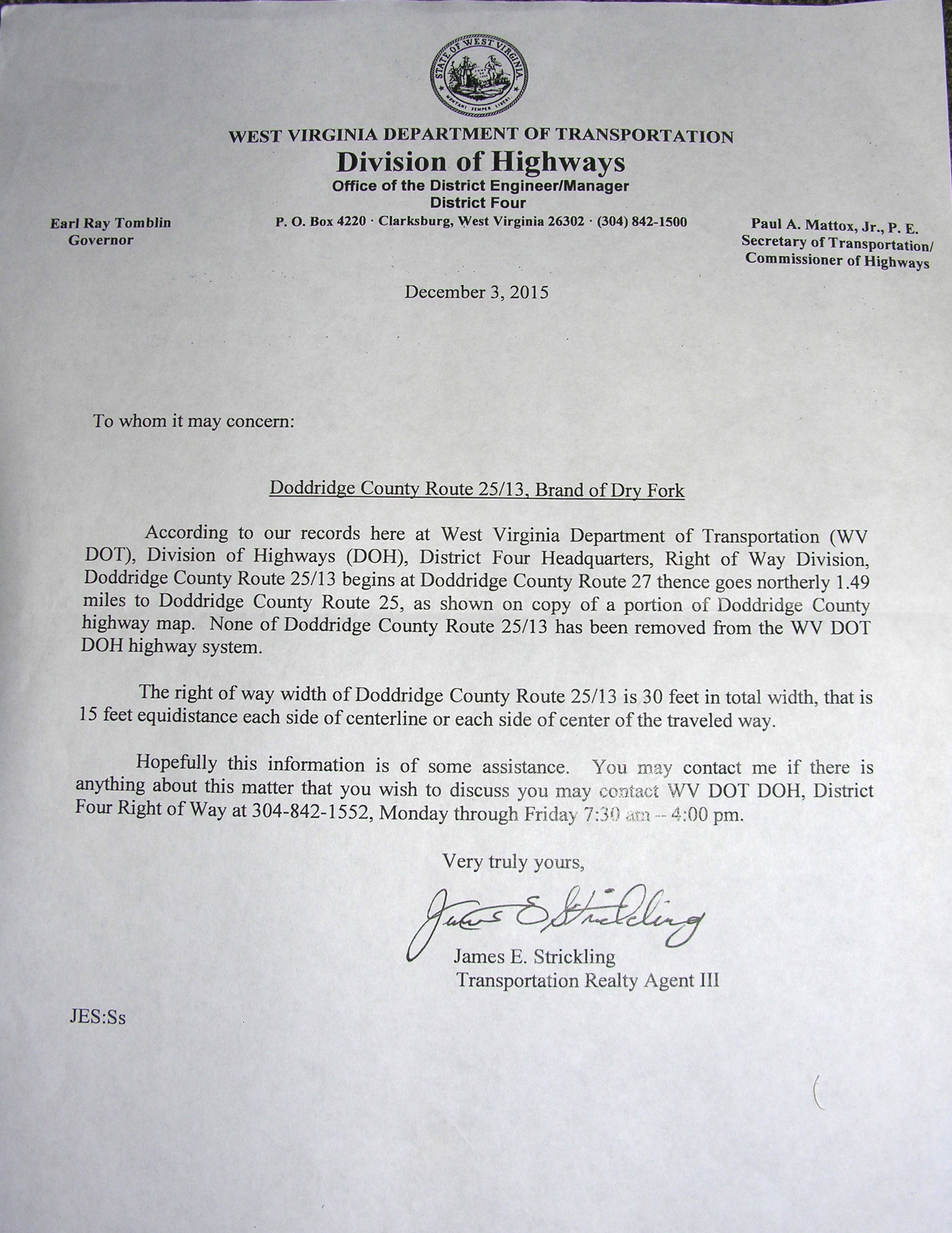
DOT workers did bring some gravel over at Justin’s urging the day he was clearing the road, and several days later, DOT had come down and graveled and graded the road towards the McClain’s driveway. DOT has since done it again.
According to Justin McClain, MVP employee Steve Randall also came by on Sept. 14 and saw that the state had fixed the road. Randall told the McClain’s that the MVP was not responsible for the flooding. No water was running off the ROW he insisted, according to Justin.
The McClain family farm is adjacent to Meathouse Fork, just downstream from the creek’s headwaters. As a consequence, a small portion of the McClain farm – the low point of the front pasture mostly – is in a floodplain according to the FEMA website. However, the property also rises nearly 500 feet in elevation. The elevation at the creek is approximately 935 feet at the front (north) end of the McClain family farm. It sits in a natural bowl below tall steep ridges that curve around their property to the east and south, with the MVP ROW surrounding them from the ridges above at 1400 feet. On the southern end of the property is a hollow that rises to a narrow, steep valley that rises that 500 feet to just below the MVP. To the east is the pond that sets above the McClain family farm.
The creek, 20 miles long, is a tributary of Middle Island Creek, which flows 77 miles to the Ohio River. Meathouse Fork did overflow its banks on the McClain farm. However, the Ann McClain photos demonstrate that the water pouring over the driveway in May is much more sediment laden, indicating it was coming from above their land – where the MVP ROW is. Also on the map, the culvert in question is not in the floodplain, but within feet of it. The sheer force of the water coming off the two hillsides and the county road next to the farm simply overwhelmed the culvert.
So, where did all that water come from?
An Independent Assessment
West Virginia Rivers worked to make sure that question is answered. The organization commissioned an independent assessment on behalf of the McClain family called a Surface Flow Analysis. Downstream Strategies of Morgantown conducted it. It leaves no doubt that water is channeling off of the MVP ROW onto the McClain property. The report states, in part, “Downstream Strategies completed a geospatial analysis to determine surface water flow pathways from the MVP’s limits of disturbance (LOD) in the vicinity (of the McClain family property) Results of the model demonstrate that water flows from the MVP LOD toward the … property. Flow paths predicted by the model are presented below.

The flow analysis shows the flow path from the ROW onto the homeowner’s property. The MVP ROW has been denuded. So there’s more water coming off the hillside. There are no more trees there. This is lot of water with no vegetation to soak it up.
– Program Director Autumn Crowe of WV Rivers
I asked Autumn Crowe, Program Director of West Virginia Rivers to share her thoughts on the Downstream Strategies Surface Flow Analysis for the McClain family property. That exchange is shared below in a Q/A format.
Q. In terms of assessing damages from a permitted project like the MVP, what are considered best practices?
A. For damage to the environment, the West Virginia Department of Environmental Protection looks at the project permit requirements to see if they are in place per the Stormwater Pollution Prevent Plan (SWPPP). So first, they look to see if sediment and erosion controls are in place. Are they effective? If not, then they (the MVP in this case) would need to update their SWPPP with plans to correct any deficiencies. What the flow analysis is telling us is that the runoff from the MVP ROW, based on GIS mapping, is going onto the McClain family property. (She emphasized, however, that it does not indicate the volume or the exact location of every area of runoff, which requires field observation. Justin McClain and I did exactly that, which you can read about below under the heading “Walking and Talking with the Subject Matter Expert”).
Q. Based on the experience the McClain family has had, it seems clear that the burden of proof falls on the landowner to demonstrate that the MVP ROW is responsible for damages such as the McClain family has endured. What is the effect of this on landowners like the McClain family – and overall impact on communities along the MVP route?

A. Yes, the burden of proof is on the impacted landowner. However, it is difficult to argue with the experience of property owners, especially one that has spent decades on the land. The property owner observing increased flooding from construction on a ridge experiences its affects. Anytime you remove trees, disturb vegetation and disturb the soil, erosion will occur. The issue then, is how they do account for the increased runoff that is occurring? It is because they’ve denuded the ridge above the property. As a scientist, the first thing I would look at is rainfall data. Were there similar rain events prior to that which hadn’t resulted in floods? One can assume the contractor’s removal of vegetation is the contributing factor.” (This research is ongoing, though complicated by the fact that the MVP has placed rain gauges since construction began, so establishing the baseline prior to the MVP’s arrival requires additional research).
Q. There was significant damage and debris, not only on the McClain family farm, but at several locations along Meathouse Fork and its tributaries. What is the ecological impact on Meathouse Fork, its tributaries and the overall health of the streams?

A. This is the exact incident we were trying to prevent when engaging in the permitting process and now we’re seeing the impact of flooding on their property. West Virginia Rivers and others appealed to all relevant agencies to require stormwater permits to account for increased precipitation due to climate change. It’s a failure of the entire system. Landowners have no idea where to go for help.
Q. What are the implications of the flow analysis? What about the culvert as the culprit?
A. The flow analysis shows the flow path from the ROW onto the homeowner’s property. The MVP ROW has been denuded. So there’s more water coming off the hillside. There are no more trees there. This is lot of water with no vegetation to soak it up.
I shared the Downstream Strategies flow analysis with Eidel. I asked him, “Do you still believe, as you shared with me the first time we talked, that the damage caused by the water runoff onto the McClain family farm on Sept. 9 was caused by the culvert and is in no way related to the MVP ROW?”
He responded via email. “Based on information from the national weather service, the storm that occurred that night produced about 2-3 inches of rain in about an hour. The daily norm for that area would be less 0.10 inches of rain. Based on that, we were looking at a 10-year event storm which would be a significant amount of rain. This would have caused a larger than normal amount of runoff from the hills in the area, this would have cause culverts in the area to plug up due to the excessive amounts of debris that would have washed down. Hope this gives you a better picture of the event that occurred.”
He included radar images from the time of the storm, which lack proper resolution for publication. However, the exact amount of rain is not in dispute; all indications are that Eidel’s estimate is accurate. What is in dispute is whether or not a small clogged culvert or water from the MVP ROW ridges above the McClain family farm is the cause of the flooding on September 9.
Crowe’s answer to that question is, “Follow the water. It will leave a sediment trail.”
Walking and Talking with the Subject Matter Expert
So, that is what I did, with Justin as my guide.
Robert McClain has lived on this farm all of his 77 years on earth. Justin McClain, 43, intends to do the same. One can understand why after hiking the land with him. It’s my reckoning that a lifelong resident of the farm – and now the primary caretaker – is the best expert to share what life was like before and since the MVP came to Big Isaac.
Notably, we found that our field observations were the opposite of what Eidel, Wine and Randall concluded.

Big Isaac is in eastern Doddridge County, near Harrison and Lewis counties (also impacted by the MVP). They are just miles south of where the MVP begins to be the conduit for fracked gas 300 miles to points south in Virginia and North Carolina.
We began our walk up the road – Branch of Dry Fork Road (County Rt. 25-13) – that comes off of Meathouse Fork Rd. and runs adjacent to the McClain family property. After just a few steps, Justin pointed to the work he had done to clean off the roadbed, observing, “These folks tell me I’m driving them crazy. Well, I just say, why don’t you just do the right thing? That’s all we’re asking.”
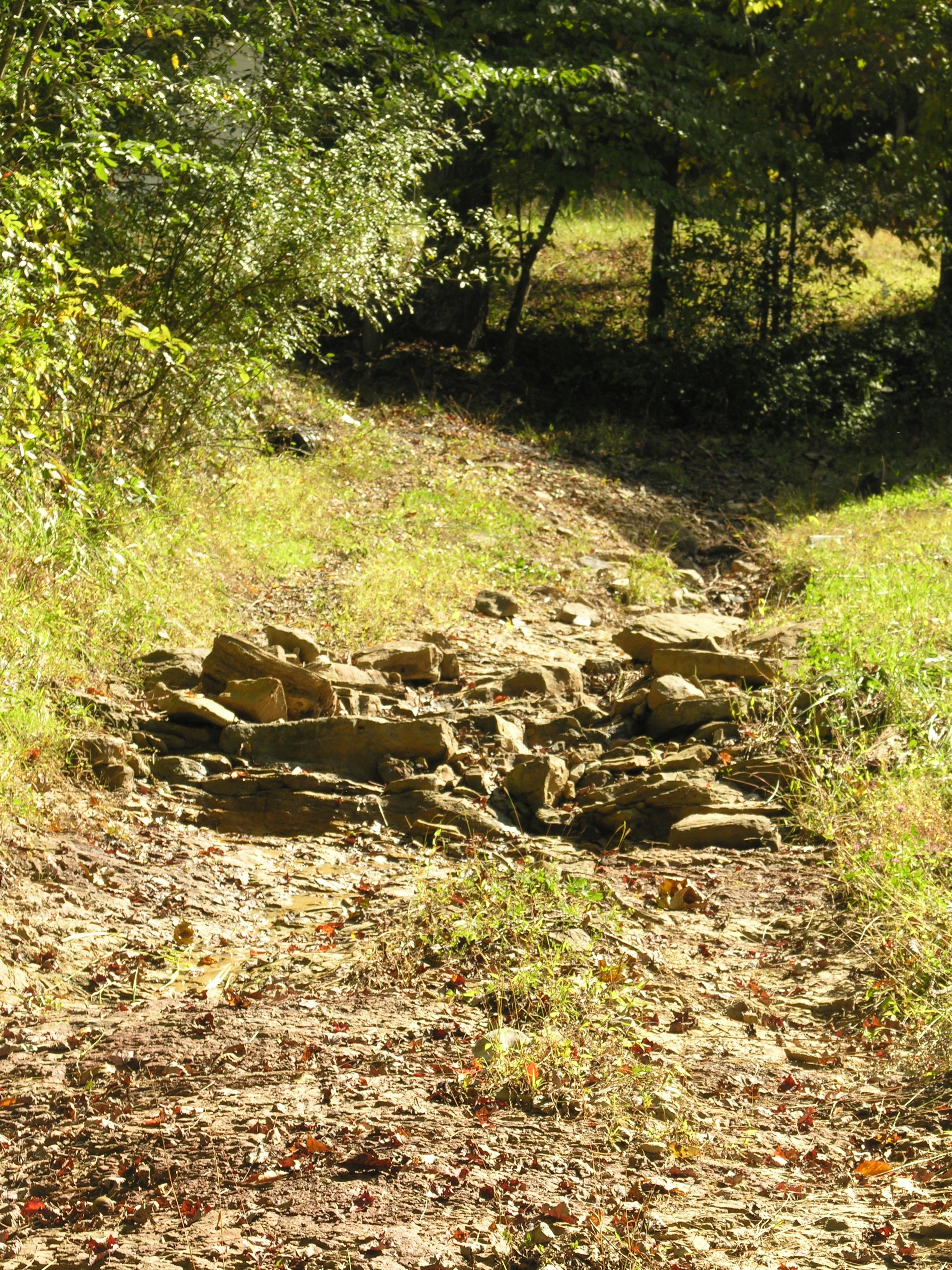
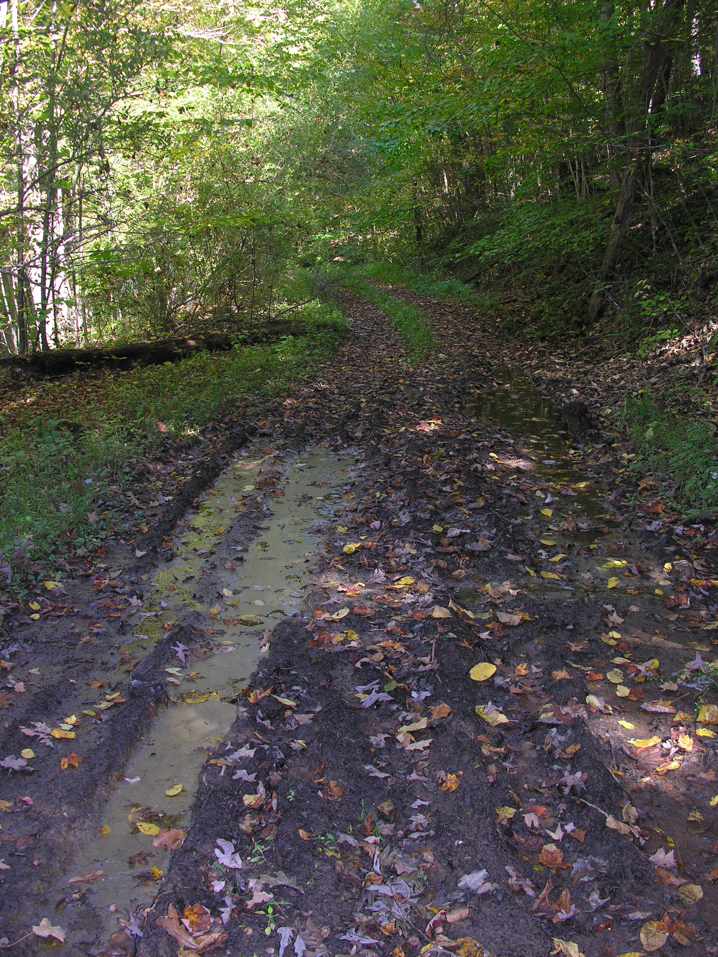
The right thing, according to Justin, is to truly stop and look at what we observed. All along the road, heading up the hill is evidence of scouring – deep ruts cut out by water.
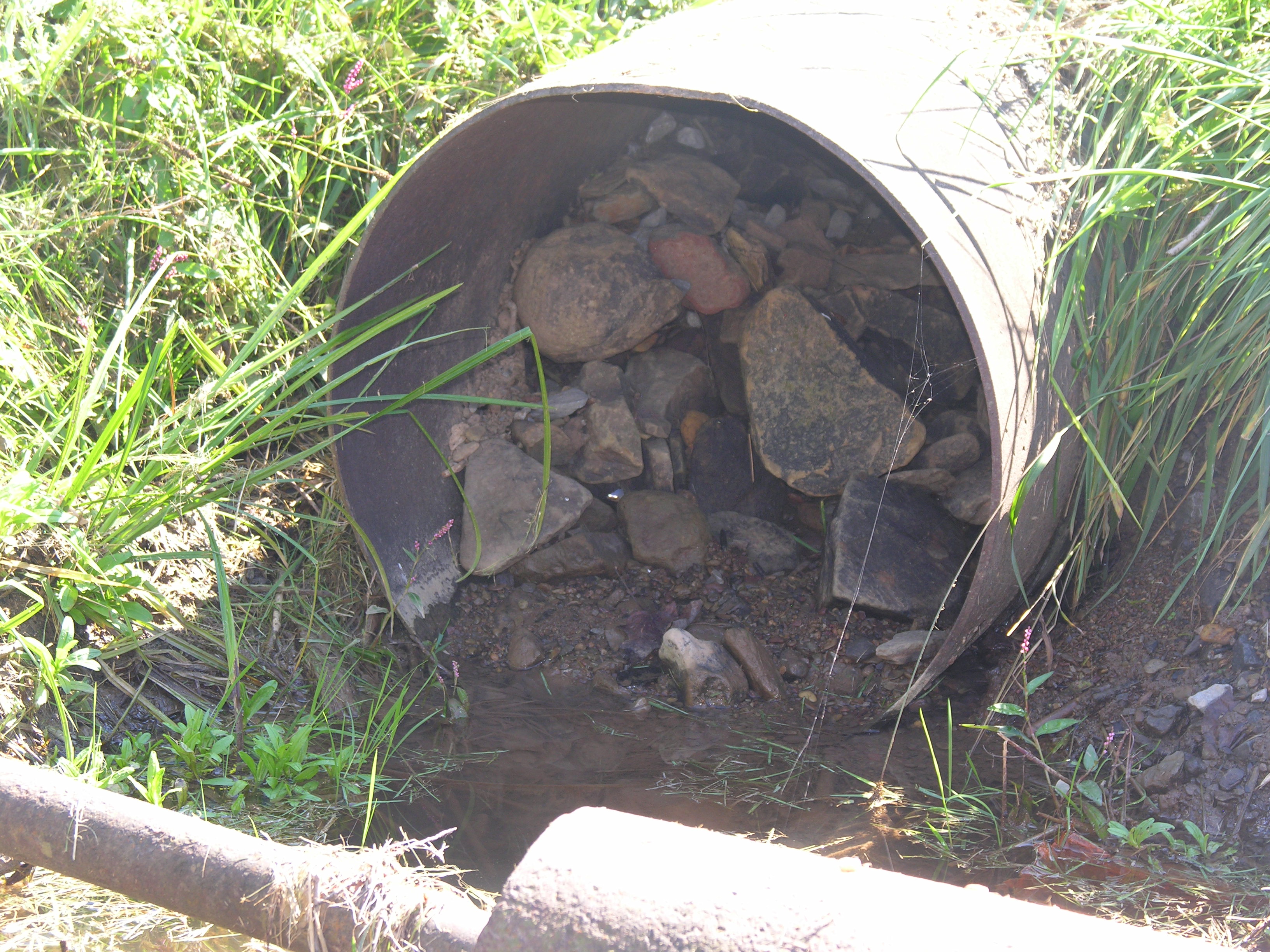
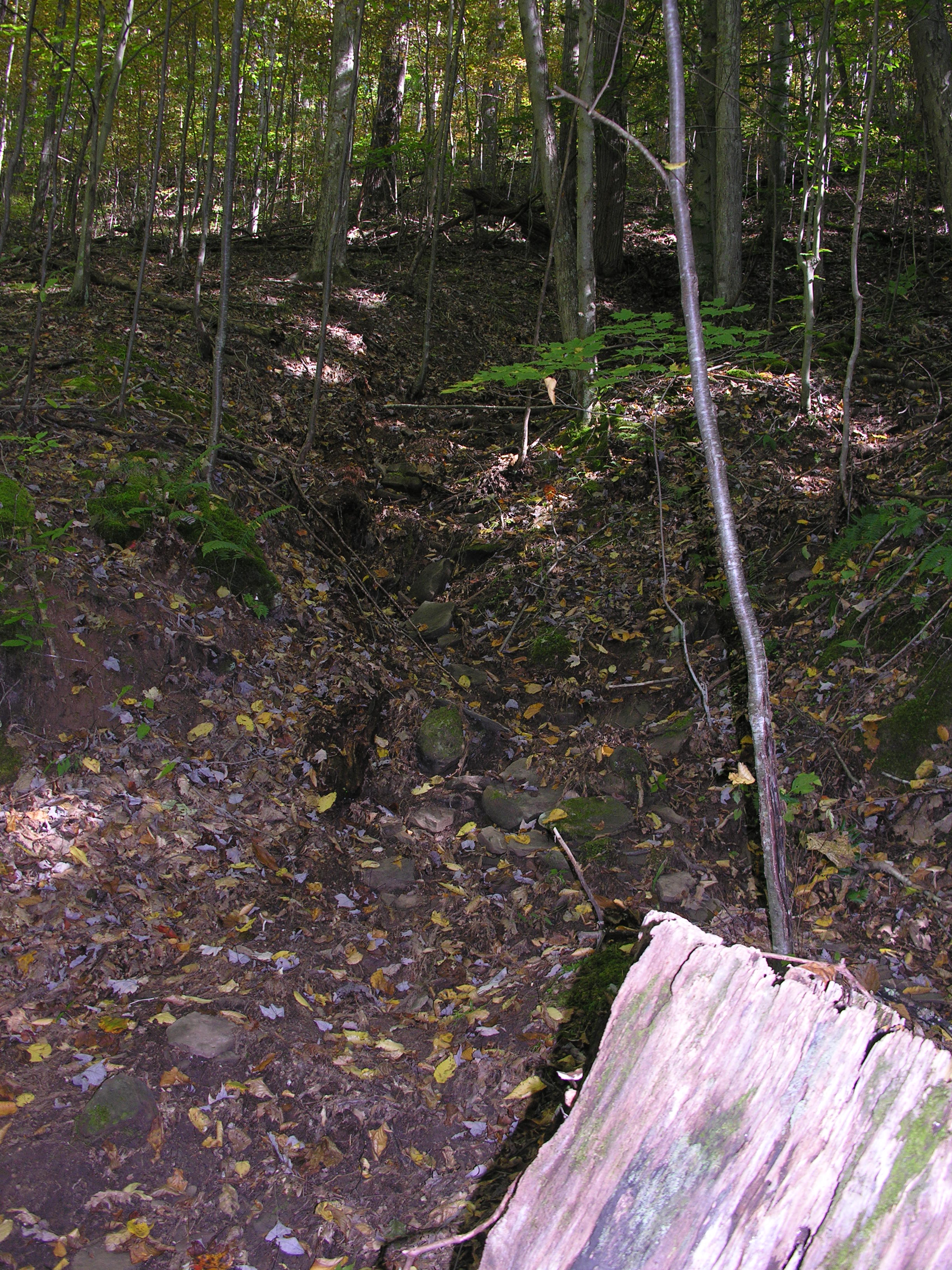
A pile of large rocks had been washed down the middle of the road, over time, making it impassable for vehicles to use. Indeed, the rocks seen in the culvert were washed down from the road, so whatever role the blocked culvert did play in the flooding was arguably a direct result of the MVP ROW flooding. Similar scenes were common all along the road. Evidence of water crisscrossing the narrow road, dropping rocks and piles of mud, was common. As we walked on up the hill, he pointed out the deep valley directly above their house next to the road. The significance of its location – and threat to flood the farm from above – became even more evident on the next leg of our trip.
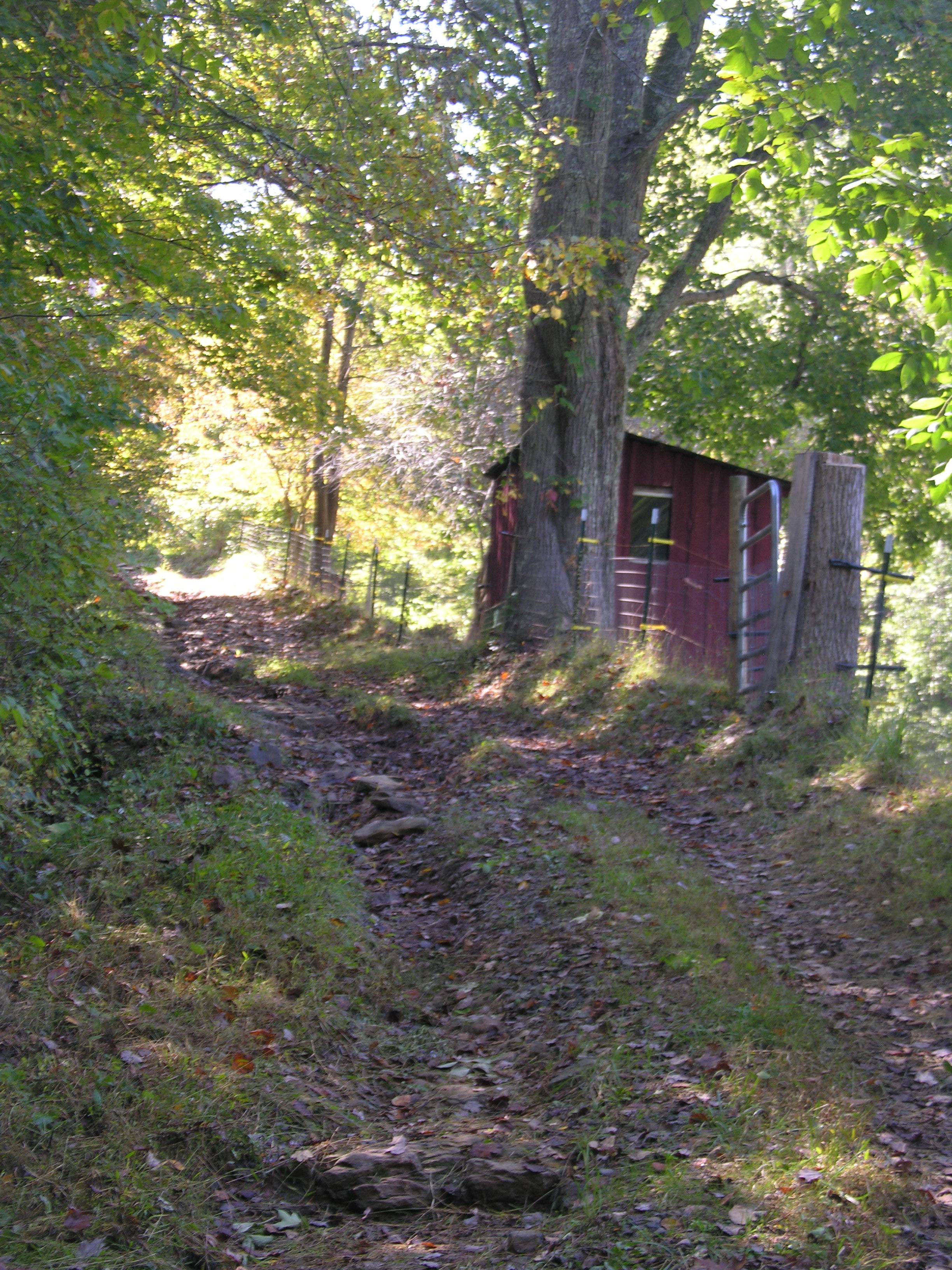
The road is actually a semi-circle that goes to the top of the ridge where it is just a couple of dozen feet below the MVP ROW. From there, it cuts back downhill and comes back out on Meathouse Fork Road a few miles downstream from the McClain family farm. This half – Dry Fork Road (County Rt. 27) – is the approved route for MVP traffic.
Justin and I ventured on up to the top driving up the same road used by MVP vehicles. Once at the top, the gravel for the MVP part ended. We walked back onto the section of the road no longer in use (County Rt. 25-13).
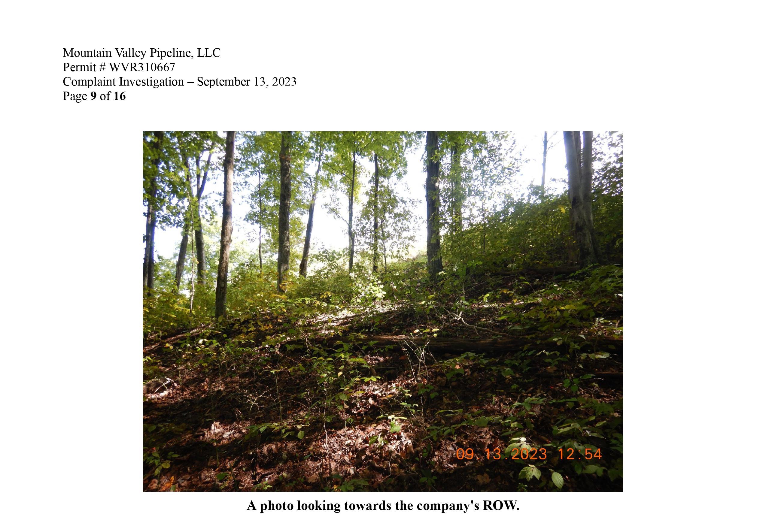
It was there that we found the clearest indication of runoff from the MVP ROW going directly onto the McClain’s property, just as the flow analysis indicates. Indeed, as one studies the flow analysis, the first two projected flow paths to the west (left) go directly towards the McClain family house. The road was inches deep in standing water and mud. Above is the MVP ROW. Below is the McClain family farm. Indeed, the second flow path from the west starts at that point and goes down the valley, also towards the home. Then the large cluster of flow paths from both the south and east ridges head directly into the farm’s pasture.
Wine claims to have investigated this area in his report, stating, “I walked further through the woods towards the Right-of-Way (ROW) of Mountain Valley Pipeline to see if there was evidence of sediment laden water coming from the site. Once I arrived on the site it was confirmed that there was no evidence of sediment laden water leaving the site.”
However, according to Justin, several feet of earth had been washed away on their side. Indeed, scouring and deep rutting – so much so that it undercut the property line fence – indicated several feet of dirt had been washed away. And the water that hadn’t gone that route simply drained down the road towards where we had seen the pile of rocks. As he reflected upon the sight, he said, “I’d rather keep my reputation as a person than be like these people. I guess that’s just the way some people think.”
A Cautionary Tale of Community Destruction
As Justin points out, that means that what they have experienced at their home and in their community – and will continue to experience – is going to be felt along the length of the MVP.
So, after finishing our tour of the farm and nearby MVP ROW, we drove around the community to see what sort of damage had been caused. When I spoke with Eidel a few days after the flood, he told me, “There was no damage to homes.” We discovered otherwise. Upstream, there were homes and property damaged. We spoke with one impacted landowner who spoke on the condition of anonymity. He said that his home had roughly four feet of water in it and that many items had been washed away, including a cement mixer. A work shed had been moved about six feet, so ferocious was the water’s current. So had a vehicle. Every piece of underpinning on one home had been washed away. Debris was everywhere.
A Failure of Initiative – Robert McClain’s Ignored Letters
Reflecting upon this decade-long saga, Justin observed, “This could have all been avoided if they had just listened to Dad.” It is hard to argue with him.
Clearly, a small clogged culvert downstream a mile or two did not – could not – have been responsible for such destruction as pictured. The cause, ultimately, was a failure by the MVP to listen to Robert McClain. The Authorities Having Jurisdiction have also not demonstrated a commitment to listen to citizens. They have shown a failure of initiative from the start.
So, the flooding has happened, just as Robert McClain had predicted. He also had warned of the dangers of using the county road adjacent to their property for driving and hauling heavy equipment to the MVP construction site, as well as other concerns.
Writing the MVP on October 8, 2015, he shared, “I have lived on this farm almost 70 years. We farm the land keeping Reg. Black Angus cattle and Club-Lamb Sheep. Our farm is completely fenced because of the livestock.”
He warned them, “The road leading to our farm is a narrow one lane road with sharp turns and curves. I keep the road ditched and my son trims the grass and trees along this narrow road. We own the land on both sides of the road mostly. It is a gravel road coming to our house from the Meathouse Fork Road. There is no way trucks and large equipment can travel this road.”
He continued, “The proposed pipeline is about 400 feet east of our land on a steep mountainside. The people who surveyed the path for the pipeline did most of the work in the dark in the evening. They did not know how the land lays or which way the water flows.”
He pointed out, “I know which direction the water flows and where erosion and damage to the land will happen. The people do not care about the land, water, trees or the lives of people living near these pipelines.”
Speaking from previous experience, McClain continued, “I have seen first-hand the damage that can be done from these large pipelines. Another company has been working on about 1000 feet north-east of our land this summer. Large amounts of water and mud washed down off 2 mountainsides, came down in a stream and ruined about 5 acres of our hayfield. As a result, we had to sell some of our cattle because of the loss of winter hay.”
He also warned of the dangers of clearing all of the trees and vegetation of ridge tops. “We will always have flooding issues with this because of the removal of all the trees. Once these pipelines are put in, things are never the same again. There is extreme erosion and sediment in the water streams.”
McClain also pointed out, “As of today no one has talked to us about this pipeline project. They have sent countless people on our land to survey and plan the destruction of our land without talking to us.” He concluded, “We hope this letter will be brought to the attention of the people in charge. … We would like for them to come talk with us about our concerns before bringing heavy equipment and destroying our homes and land.”
Conclusion
The MVP never did. The only response was from the West Virginia Division of Highways. They simply stated the impassable county road was still on the state map. They did not acknowledge Robert McClain’s concerns. As a result, of all the various impacts experienced by the McClain family for the past decade or so, perhaps the most harmful is their jaded view of the gas industry and local, state and federal authorities charged with protecting the public from the harm it causes.
Robert McClain said the motive is not complicated to understand. “They don’t care about the people and land. They’ve destroyed Doddridge County. It’s all about the money.”
Ann added, “They’ve destroyed everything. They’ve ruined the water. I don’t believe it. Everyone says I’m a complainer. Well, I think they’re selling out. They get all the money, we get all the noise.”
Justin summed it up with straight-shooting, West Virginian dry wit. “They think water runs uphill.”
© Michael M. Barrick, 2023. To learn more about the MVP and fracking, take a moment to learn about my book, “Fractured Sanctuary: A Chronicle of Grassroots Activists Fighting Pipelines of Destruction in Appalachia.” All revenues from book sales are used to continue this reporting. You can also read the first story I wrote about the McClain family as they dealt with the Stonewall Gas Gathering Pipeline in 2015 here. It is this project Robert McClain references in his letter.

Wh
[…] UNION, W.Va. – Yesterday, we reported upon the ongoing flooding in Doddridge County, W.Va. In it, we offered evidence that demonstrates that the Mountain Valley Pipeline (MVP) Right-of-Way […]
[…] ‘Following the water’ provides a trail straight to MVP in West Virginia – 12/10/2023, Appalachian Chronicle […]
[…] While the MVP and George Eidel, Director of the Office of Emergency Services for Doddridge County have not responded to questions as to what happened on the ridge above Big Issac, drone footage taken in early December reveals an extensive repair of hundreds of yards of the MVP ROW. It has been reseeded since West Virginia Department of Environmental Protection (WVDEP) Inspector Timothy Wine took a photo of the ROW on September 13. His photo (below) was taken in response to a complaint about flood damage from a September 9 storm likely caused by the MVP. […]
[…] about Authorities Having Jurisdiction turning a blind eye to MVP violations and damages, despite independent evidence pointing to the MVP as the primary cause of a destructive flood here in Septemb…. Families have lost their homes or had them rendered uninhabitable because of the dangers […]
[…] from the MVP floods farms in Doddridge County, W.Va. Photo by Ann […]
[…] ‘Following the Water’ Provides a Trail Straight to the MVP in West Virginia Flash Floods […]
[…] ‘Following the Water’ Provides a Trail Straight to the MVP in West Virginia Flash Floods (12/10/23) […]
[…] ‘Following the Water’ Provides a Trail Straight to the MVP in West Virginia Flash Floods (12/10/23) […]
[…] ‘Following the Water’ Provides a Trail Straight to the MVP in West Virginia Flash Floods […]
[…] ‘Following the Water’ Provides a Trail Straight to the MVP in West Virginia Flash Floods […]